How to draw Ghana map
Ghana is a country located in West Africa. It is bordered by Ivory Coast, Burkina Faso, Togo and by the Gulf of Guinea. Ghana is known for its vibrant culture and diverse geography.
Drawing a map of Ghana can be a fun, educational project that can help you learn about the geography of this African nation.
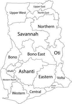
Ghana is split into sixteen egions, and the border lines between these regions are very important when drawing the map. This article will provide you with step-by-step instructions on how to draw a map of Ghana.
What is a map?
A map is a symbolic depiction emphasizing relationships between elements of some space, such as objects, regions, or themes. Many maps are static, fixed to paper or some other durable medium, while others are dynamic or interactive.

How to draw Ghana map
1. Gather your supplies
Before you begin, make sure you have all of the necessary supplies. You will need a large piece of paper for the map, as well as a pencil and eraser. You may also want to use a ruler or other straight-edge.
2. Research the Geography
It is important to get a general idea of the geography of Ghana before you start drawing. Do some research online or in books to find out the location of major cities, rivers, and other geographical features.
3. Draw the outline
Once you have a good understanding of the geography of Ghana, you can begin to draw the outline of the country. Start by drawing the coastline of Ghana. Then, draw the borders between Ghana and its neighboring countries.
4. Draw the major cities and rivers
Now that you have the outline of the country drawn, you can begin to add the major cities and rivers. Use your research to determine the location of the major cities, such as Accra and Kumasi. You can also add the major rivers, such as the Volta and the Oti.
5. Fill in the details
Once the major features are drawn, you can start to fill in the smaller details. This includes smaller cities, mountains, and other features. Make sure to use your research to draw the features accurately.
- Advertisement -
6. Shade the Map
Once all of the details are drawn, you can begin to shade the map. This will help to give the map a more realistic look. You can use different colors to represent different geographical features, such as mountains, rivers, and lakes.
7. Add Labels
The last step is to add labels to the map. You can use the research you did to label the major cities and rivers. You can also add labels for smaller features, such as mountains, lakes, and national parks.
Which App can i use to draw a map?
You can use Adobe Photoshop, Coraldraw or a simple app called, SmartDraw which runs on any computer or mobile device and works with Windows, MacOS, Android, iOS, or any other platform.
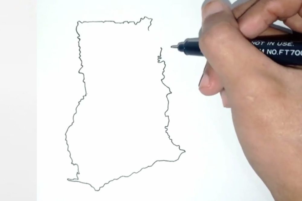
Drawing sketch of Ghana map
The image below shows a drawing sketch of Ghana map.
Conclusion
That’s it.! Following this guide should make it easy for you to draw the map of Ghana accurately. Remember to pay attention to the border lines and the regional boundaries.